
Abram S. Hewitt State Forest
Abram S. Hewitt State Forest is located in Hewitt, New Jersey. A section of Bearfort Ridge, as well as the Appalachian Trail reaches in
Details
Absecon Lighthouse
New Jersey's tallest lighthouse awaits you at Pacific and Rhode Island Avenues in Atlantic City (walking distance from the Atlantic Cit
Details
Allaire Campground
Allaire campground offers tent/RV/drive up camping, along with Yurt and Cabin rentals. Plus you will be right across the street from Al
Details
Allaire Group Campground
The group campground in Allaire is located along the south eastern side of Allaire SP. It offers 6 large sites, lots of trails, and clo
Details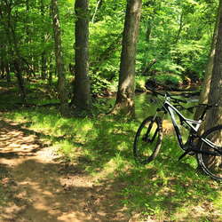
Allaire State Park
Allaire state park offers biking, a historical village, hiking, railroads, trails, fishing, deep woods, and many acres to explore.
Details
Allamuchy Mountain State Park
Allamuchy Mountain State Park offers a wide variety of activities, mainly consisting of hiking and mountain biking through miles of sce
Details
Atsion Recreation Area
The Atsion Mansion was built in 1826 as a summer home for Samuel Richards. Richards, who a prominent ironmaster from Philadelphia, was
Details
Barnegat Light House
The Barnegat Lighthouse contains picnic areas, trails along the inlet and to the beach, and of course the lighthouse itself. During th
Details
Bass River State Forest
Bass River State Forest was the first forest acquired by the state of New Jersey in 1905 for public recreation, water conservation, and
Details
Belleplain State Forest
The forested acres of Belleplain include stands of young pine, oak and Atlantic white cedar, reflecting better soil conditions and less
Details
Brendan T. Byrne State Forest
Formerly known as Lebanon State Forest, visitors are greeted by the fresh scent of pines. Today, hikers can follow the sandy trails and
Details
Cape May Point State Park (and lighthouse)
Located on the southern tip of New Jersey, Cape May Point State Park is a key site on the NJ Coastal Heritage Trail, with an environmen
Details
Cheesequake Campground
53 tent and trailer sites with fire rings and picnic tables. Flush toilets and shower facilities are within walking distance. Trailer s
Details
Cheesequake State Park
Cheesequake State Park offers hiking, bike, walking, swimming, camping, and much much more for every who visits.
DetailsCorson's Inlet State Park
Corson's Inlet State Park offers outstanding scenic beauty and endless opportunities for observing a multitude of migratory and residen
Details
Double Trouble State Park
Double Trouble State Park offers an outstanding example of the Pine Barrens ecosystem and a window into the Pine Barrens history.
Details
Edwin B. Forsythe National Wildlife Refuge
The Edwin B. Forsythe National Wildlife Refuge protects more than 47,000 acres of southern New Jersey coastal habitats which is activel
Details
Fort Mott State Park
Fort Mott was part of a coastal defense system designed for the Delaware River in the late 1800s
Details
Hacklebarney State Park
Hacklebarney State Park offers miles of hiking, multiple waterfalls, and fishing access to the great black river
Details
High Point State Park
The view from High Point Monument, at 1,803 feet above sea level, is a spectacular panorama of NJ/NY/PA. Trails around the entire park
Details
Historic Allaire Village
The historic Allaire Village contains buildings from the 19th century, including a general store, blacksmith shop, carpenters shop, man
DetailsHistoric Cold Springs Village
Historic Cold Spring Village in Cape May is an Early-American open-air living history museum! Step back in time to the 1800s while visi
Details
Historic Longstreet Farm
The sights, sounds, and smells of rural Monmouth County in the 1890s have been re-created on nine acres at Historic Longstreet Farm in
Details
Island Beach State Park
Island Beach State Park, located in Ocean County NJ, offers beach access, cartop boat launching, walking trails through natural dunes,
Details
Jenny Jump Campground
Located in the northern section of Jenny JumpState Forest, you will find 20+ campsites, 2 group camping areas, and 8 shelters (cabins).
Details
Jenny Jump State Forest
Jenny Jump State Forest offers great views, great hiking, camping and more.
Details
Jungle Habitat
Jungle Habitat is maintained by Ringwood State Park, and is used by hikers, bikers, bird watchers. It contains miles of trails that wea
Details
Kittatinny Valley State Park
Glacial lakes, limestone outcroppings, former railroads, and a small airport are features of Kittatinny Valley State Park. Lake Aerofle
Details
Liberty State Park
Liberty State Park is a green oasis in the middle of Metropolitan northern New Jersey. With the Manhattan skyline, the Statue of Libert
Details
Long Pond Ironworks State Park
Information about Long Pond Ironworks State Park coming soon. Please visit their site for more information.
Details
Monmouth Battlefield State Park
Monmouth Battlefield State Park preserves a splendid rural 18th-century landscape of hilly farmland and hedgerows that encompasses mile
Details
New Jersey State Botanical Garden
From the delicate shades of a tiny wildflower to the vibrant colors of massed annual plantings, Skylands is a place of beauty in any se
DetailsNew Jersey State Museum
The New Jersey State Museum serves the life-long educational needs of residents and visitors through its collections, exhibitions, prog
Details
Norvin Green State Forest
The undisturbed forest and rugged terrain of Norvin Green offers sanctuary for birds and other wildlife. Part of the Wyanokie Wildernes
DetailsPequest Trout Hatchery and Natural Resource Education Center
The Pequest facility includes a Natural Resource Education Center for environmental education as well as the only state-owned and opera
Details
Planetarium at the New Jersey State Museum
Soar through the skies in the Museum's spacious Planetarium, featuring precision projection of more than 6000 stars.
Details
Ramapo Mountain State Forest
This hilly forest is a sanctuary for wildlife. Hikers and mountain bikers enjoy miles of challenging trails. Many trails offer a view o
Details
RC Flying Field (within Allaire State Park)
The Jersey Coast Radio Control Club flies here anytime they can.
Details
Ringwood State Park
Ringwood State Park offers so much for people of all levels to do throughout the year, including mountain biking, hiking, fishing, shoo
Details
Spruce Run Recreation Area
Surrounded by the rolling hills of Hunterdon County, Spruce Run Recreation Area is popular with picnickers, swimmers, fishermen, boater
Details
Stokes State Forest
Stokes State Forest offers activities ranging from mountain biking, hunting, fishing, hiking camping, and much more. All in an amazing
Details
Sunrise Mountain Scenic overlook
Enjoy breathtaking views of Sussex county on Sunrise Mountain Scenic overlook
DetailsSwartswood State Park
Swartswood State Park offers boating, paddling, fishing, kayaking, swimming, camping, hiking, nature trails, bathrooms.
Details
Tillman Ravine
The hiking trails on Tillmans Ravine lead you through pine and hemlock forests, across bridges, down alongside a fast moving and beauti
Details
Voorhees State Park
Voorhees State Park offers camping, nature trails, overlooks of NYC, a nice observatory, and much more.
Details
Voorhees State Park Campground
Listing Added On Feb 14th. Information Coming Soon.. Voorhees State Park Campground
Details
Voorhees State Park Observatory / NJAA
Voorhees State Forest Observatory, public events, NJAA, star watching, telescopes
Details
Washington Crossing State Park (NJ)
Both a historic location and just a beautiful place to visit, Washington Crossing State Park has a lot to offer anyone looking to get o
Details
Waterloo Village
Waterloo Village, 19th century Morris Canal port town, is a National Historic Site. It is located along the banks of the Musconectcong
Details
Wawayanda State Park
Wawayanda State Park contains miles of amazing trails, a large fishing/swimming/paddling lakes, and so much more.
Details
Wharton State Forest
Throughout Wharton are rivers and streams for canoeing, hiking trails (including a section of the Batona Trail), miles of unpaved roads
DetailsWorthington State Forest
Some of the most rugged terrain and splendid views of northern New Jersey are found in Worthington State Forest. A rocky and sometimes
Details
Post Comments